
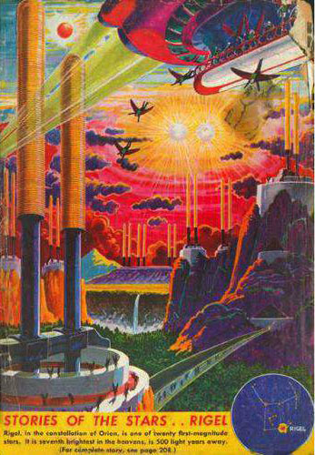
 Stories of the Stars: Rigel. Artwork by Frank Paul
|
Here is a quick index of starmaps at this site, plus a few from elsewhere on the net.
|
By popular demand I am using the power of Cafe Press to make available reasonably priced poster sized versions of my star maps. The largest are 23" x 35", the smallest will probably be 11" x 17".

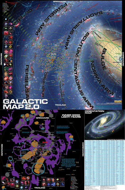 |
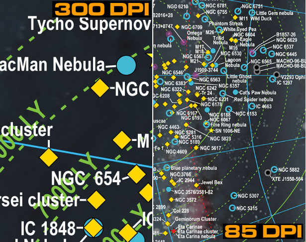
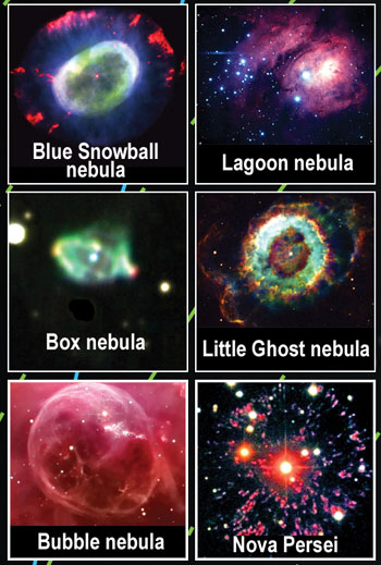
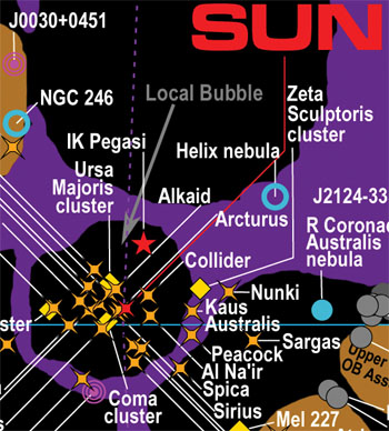
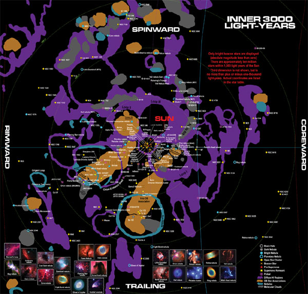
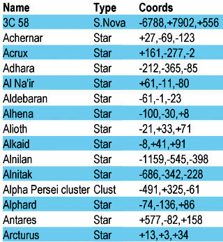
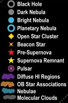
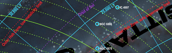
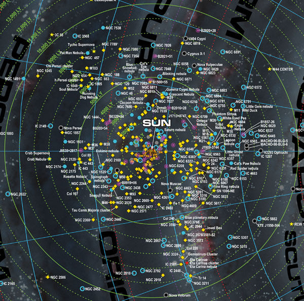
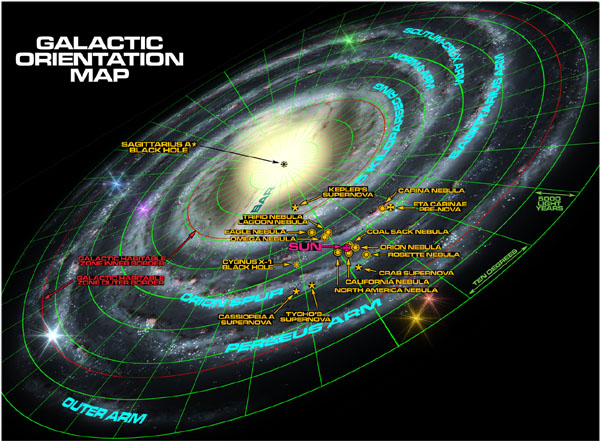
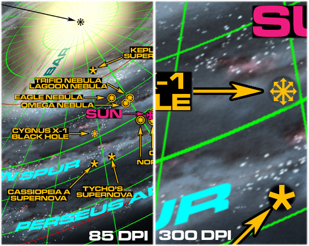
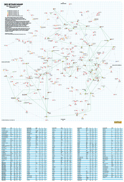
Map Poster #4: Galactic Map 2.0Full Size 23” X 35” This a map of the entire Milky Way Galaxy, or at least the rimward half of it at any rate. It displays the locations of the spiral arms, suspected black holes, major dark/bright/planetary nebulae, open star clusters, bright beacon stars, supernova remnants, pre-supernovae, and pulsars. It is a Cartesian plot with the x-y plane parallel to the plane of the galaxy. The positive X-axis points at the galactic center ("Coreward"), the negative X-axis points at the galactic rim ("Rimward"), the positive Y-axis points in the direction of galactic rotation ("Spinward"), the negative Y-axis points opposite to the galactic rotation ("Trailing"). Distances are in light-years. The sources of the astronomical data used to create the map are listed. Distances from the galactic core are displayed in blue, distances from the sun are displayed in green. The map is in four sections. The upper section charts the galaxy from the galactic core almost to the rim (about 45,000 light-years). The lower left section zooms into the area within 3,000 light-years of the sun. The upper part of the lower right section has a rough "orientation map" of the entire galaxy, similar to the one in the RECONS map. And the lower part of the lower right section has a table of all the objects on the map, a list of astronomical sources used, and a few notes. It is my opinion that if one has already purchased the prior 1.0 version of the map, it is probably not worth it to get the version 2.0 map. Not enough changed. The main difference is the labels for the spiral arms. The second most important difference is the increase in size of the object table (the old one was just a bit too hard to read). G0.9+0.1 supernova remnant added and labeled "youngest known supernova". Betelgeuse, Antares, Spica, and Gama2 Velorum were re-labeled as "pre-supernovae." RS Ophiuchi, HD 179821, IRC+10420, and VY Canis Majoris pre-supernovae added. WR 104 pre-supernova added with the label that its radiation axis is aimed straight at Earth. Star HE1327-2326 added with the label "Oldest known star" and star EGG M16-E42 added and labeled the youngest. RX-J185635-375 and 3C58 added as quark stars. |
Sources for astronomical data:
Notes:
In some cases distance data was tweaked when different catalogs assigned inconsistent distances to objects that are actually associated.
"Beacon” stars are bright stars with absolute magnitudes of zero or less.
“Pre-supernova” stars are commonly believed by astronomers to be on the verge of exploding Real Soon Now (i.e., anytime from one million years from now to tomorrow).
“Collider” is Gliese 710. There is a fair chance it will collide with our solar system in approximately 1.4 million years, or at least pass by close enough to initiate a deadly hail of comets.
The “local bubble” is an area of reduced density in the interstellar medium, which is bad news for Bussard Ramjet spacecraft. It was probably created by the detonation of the SN437 Geminga supernova.
Only the Sunward half of the galaxy was plotted due to a lack of data for objects on the far side.
Blue lines measure angles and distances from the galactic core. Green lines measure distances from the Sun.
Red lines delineate the controversial “Galactic Habitable Zones. ”Red lines for “low metalicity limit” and “safe supernova limit” are from Lineweaver et al, other red lines are from Gonzalez et al.
Distances are in light-years instead of parsecs, which will please science fiction writers and annoy astronomers.
Grid and astronomical objects were plotted by a Python program using the Report Lab library, orientation map was created with the Blender 3D modeling package.
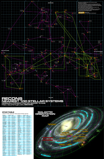 |
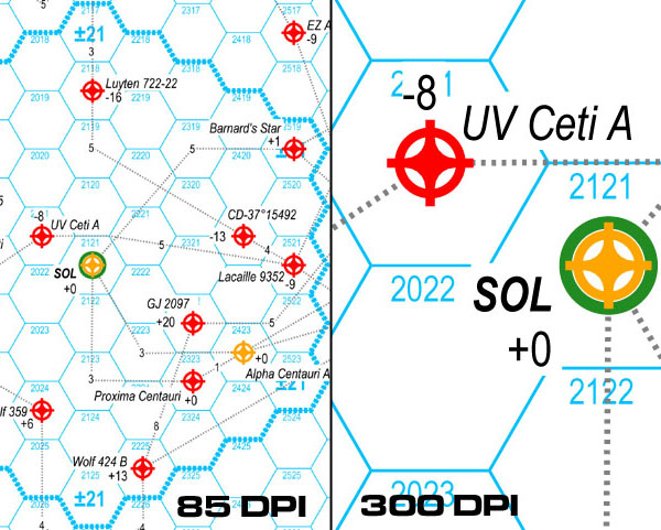
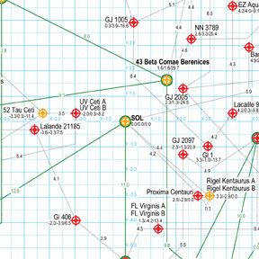
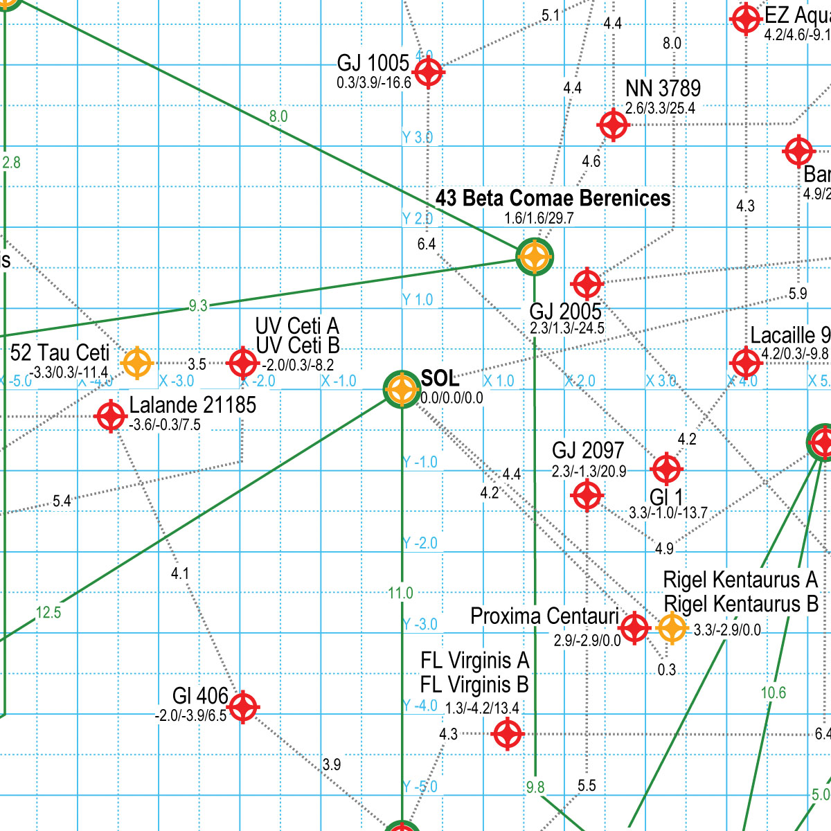
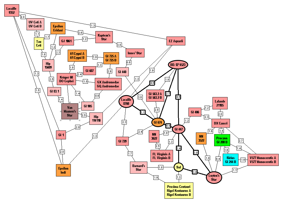
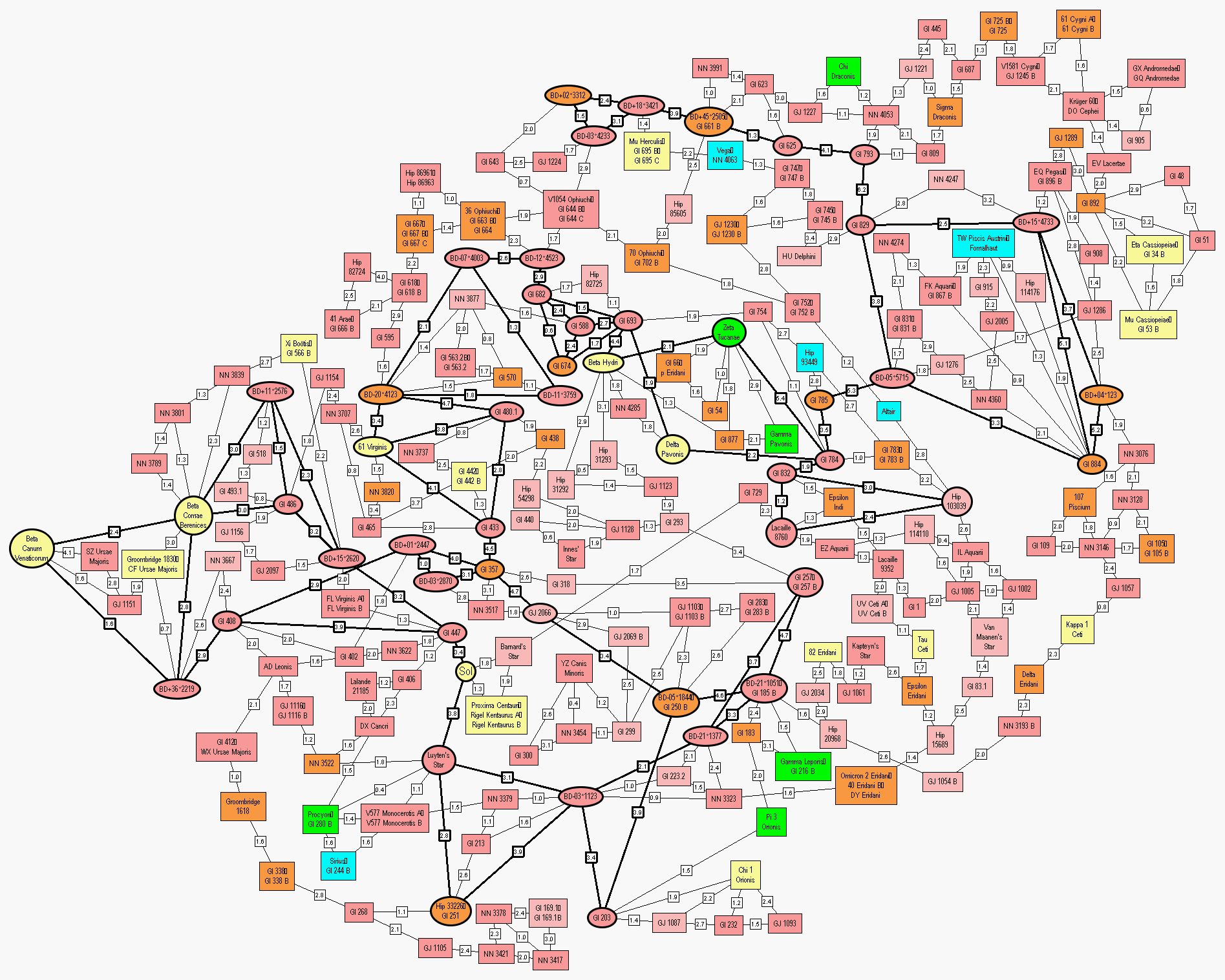
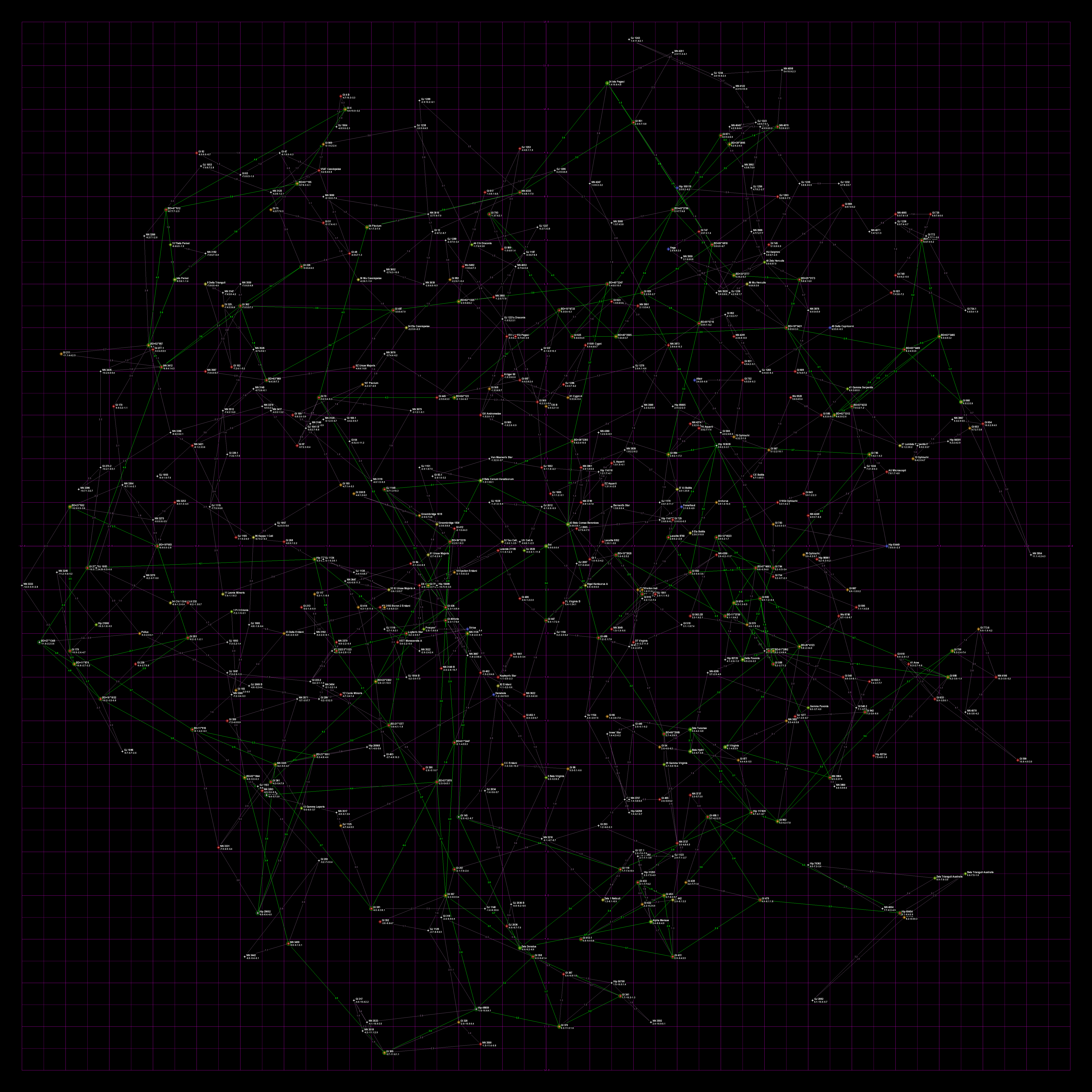
Map Poster #3: 100 Nearest StarsFull Size 23” X 35” This is a map of the 100 nearest stars to the Sun, according to the RECONS dataset. The map comes in a full sized 23" x 35" poster, and a small size 16” X 20” poster. It is a Cartesian plot with the x-y plane parallel to the plane of the galaxy. The positive X-axis points at the galactic center ("Coreward"), the negative X-axis points at the galactic rim ("Rimward"), the positive Y-axis points in the direction of galactic rotation ("Spinward"), the negative Y-axis points opposite to the galactic rotation ("Trailing"). Distances are in light-years. Stars are indicated by an icon color coded to the spectral class of the star (or the brightest star if it is a multiple star system). Stars listed in the HabCat database have a high probability of possessing a human habitable planet and are marked with a gold ring. |
Stars are labeled with the name of all stars in the system and with the x,y,z Cartesian coordinates. Overlapping star icons are moved slightly for clarity, but the Cartesian coordinates are accurate.
Violet lines are drawn between each star and its two closest neighbors, and the lines are labeled with the distance. In addition, HabCat stars have green lines to their two closest HabCat stars.
In the bottom part of the poster is a table of all the stars on the map. The table includes the star name, HabCat status, spectral class, and Cartesian coordinates. On the right side is a simple map of the galaxy, to provide orientation.
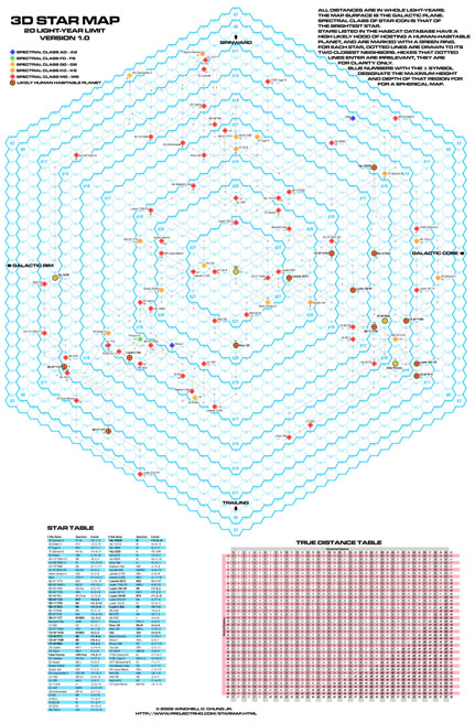 |
Map Poster #2: 20 Light Year Hex MapFull Size 23” X 35” Small Size 16” X 20” This is a map of all known stars within 20 light-years of the Sun. The map is plotted on a hex grid, suitable for playing war games. The map is similar to the one found in the out-of-print wargame StarForce. The map comes in a full sized 23" x 35" poster, and a small size 16” X 20” poster. The hexes on the full size map are large enough to accommodate a standard wargame playing counter. The other has hexes that are too small, but can be used as campaign planning maps. Distances are in light-years. Each hexagon is one light-year in diameter. The map is spherical, so the various ring-shaped regions are labeled with the maximum height or depth values that will still be within the spherical boarder. Stars are indicated by an icon color coded to the spectral class of the star (or the brightest star if it is a multiple star system). Stars listed in the HabCat database have a high probability of possessing a human habitable planet and are marked with a green ring. |
Stars are labeled with the name of the brightest star in the system and with the height or depth from the surface of the map.
Dotted lines are drawn between each star and its two closest neighbors, and the lines are labeled with the distance. The hexagons the lines enter are immaterial. The lines should be straight but are artistically bent to flow along hexagonal lines in the name of clarity.
In the bottom part of the poster, to the left, is a table of all the stars on the map. The table includes the star name, HabCat status, spectral class, and Cartesian coordinates.
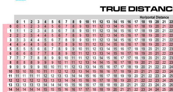
To the right is a True Distance table, used to calculate the actual three dimensional distance between any two points. Cross reference the horizontal distance between the two points in hexagons with the vertical distance on the table to find the actual distance. Distances too far to fit inside the spherical bounds of the map are marked in bold print.
 |
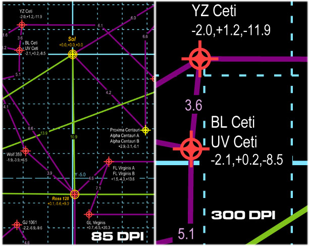
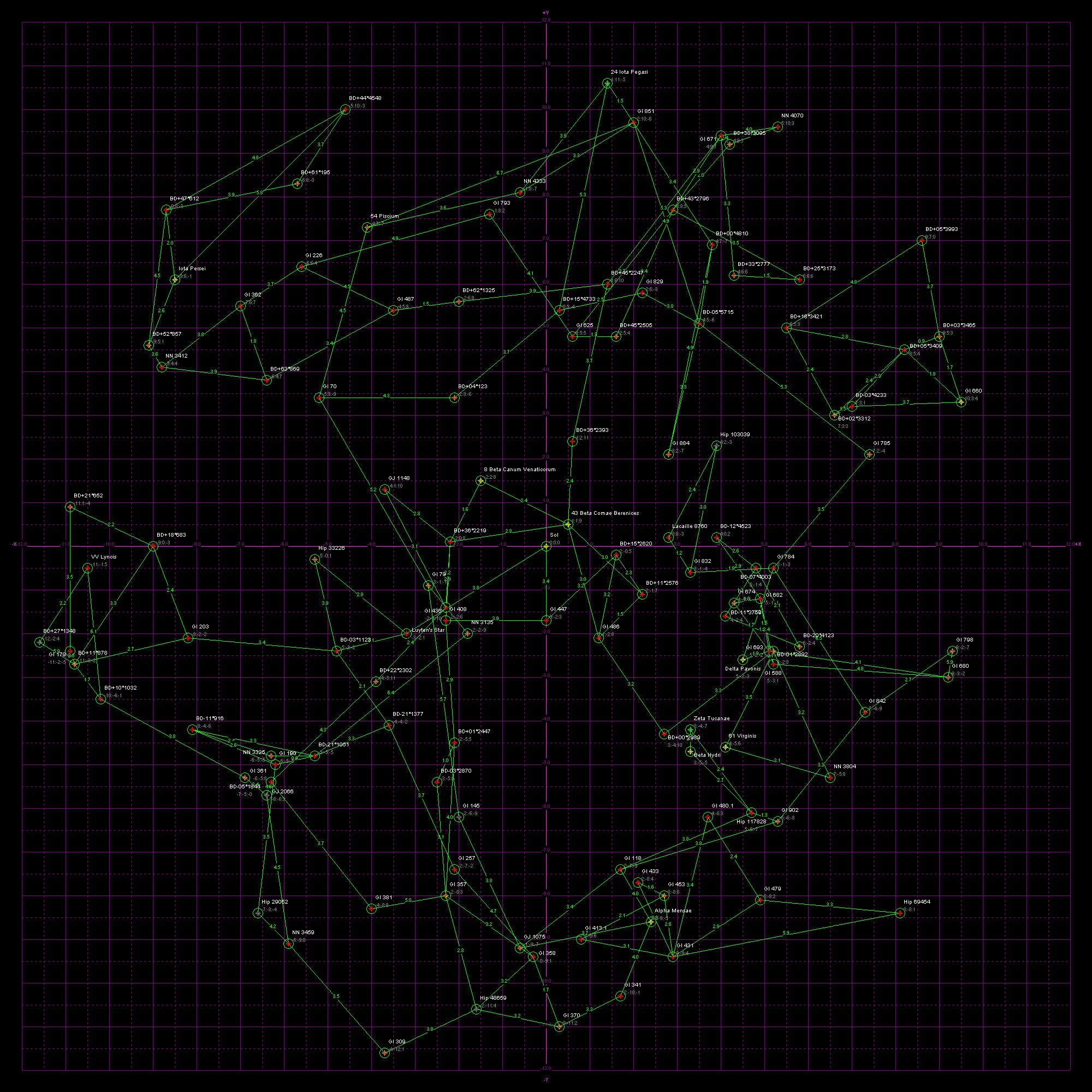
Map Poster #1: 30 Light YearsFull Size 23” X 35” Small Size16” X 20” The first is a map of all known stars within 30 light-years of the Sun. This map is intended for SF authors plotting out their SF universes. The map comes in a full sized 23" x 35" poster, a small size 16” X 20” poster. The small size poster lacks the tables. It is a Cartesian plot with the x-y plane parallel to the plane of the galaxy. The positive X-axis points at the galactic center ("Coreward"), the negative X-axis points at the galactic rim ("Rimward"), the positive Y-axis points in the direction of galactic rotation ("Spinward"), the negative Y-axis points opposite to the galactic rotation ("Trailing"). Distances are in light-years. Stars are indicated by an icon color coded to the spectral class of the star (or the brightest star if it is a multiple star system). Stars listed in the HabCat database have a high probability of possessing a human habitable planet and are marked with a green ring. |
Stars are labeled with the name of all stars in the system and with the x,y,z Cartesian coordinates. Overlapping star icons are moved slightly for clarity, but the Cartesian coordinates are accurate.
Dotted lines are drawn between each star and its two closest neighbors, and the lines are labeled with the distance. In addition, HabCat stars have lines to their two closest HabCat stars.
In the bottom part of the poster is a table of all the stars on the map. The table includes the star name, HabCat status, spectral class, and Cartesian coordinates.
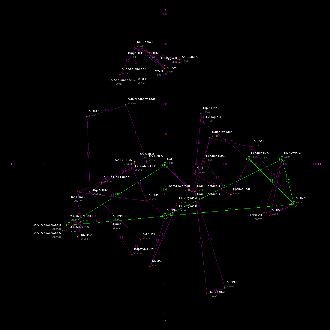
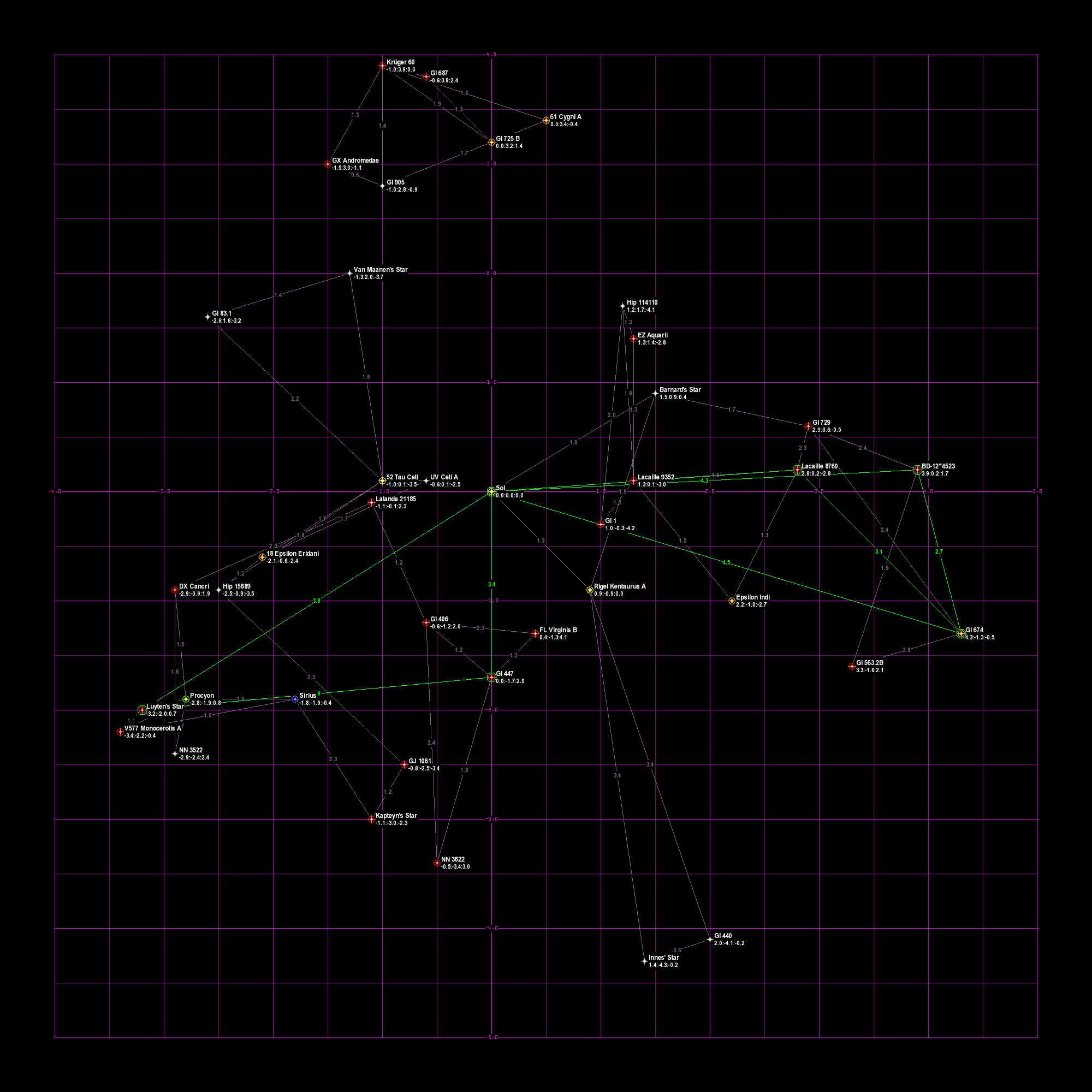
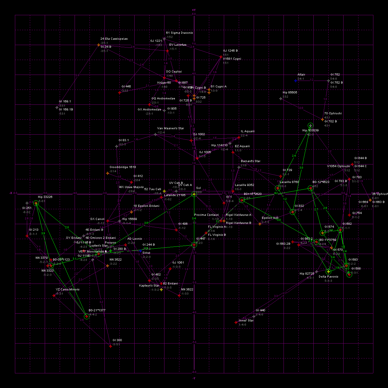
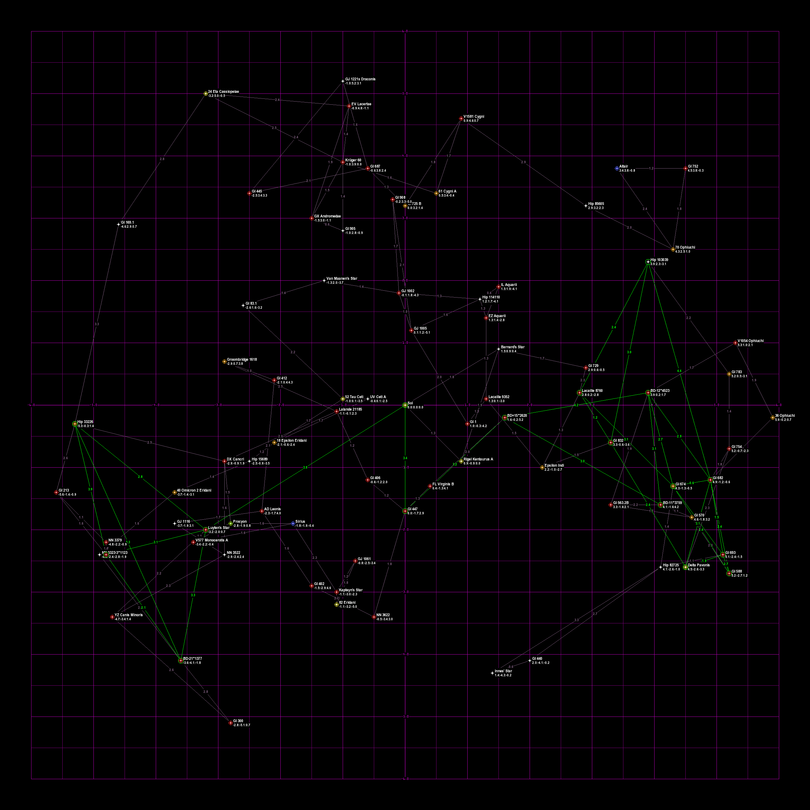
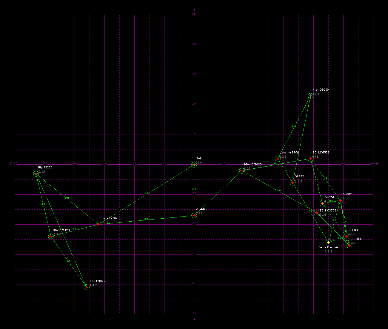
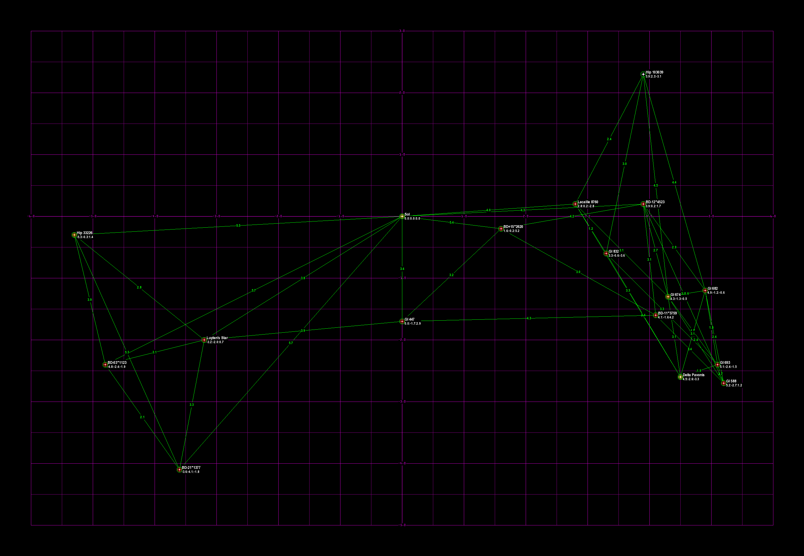
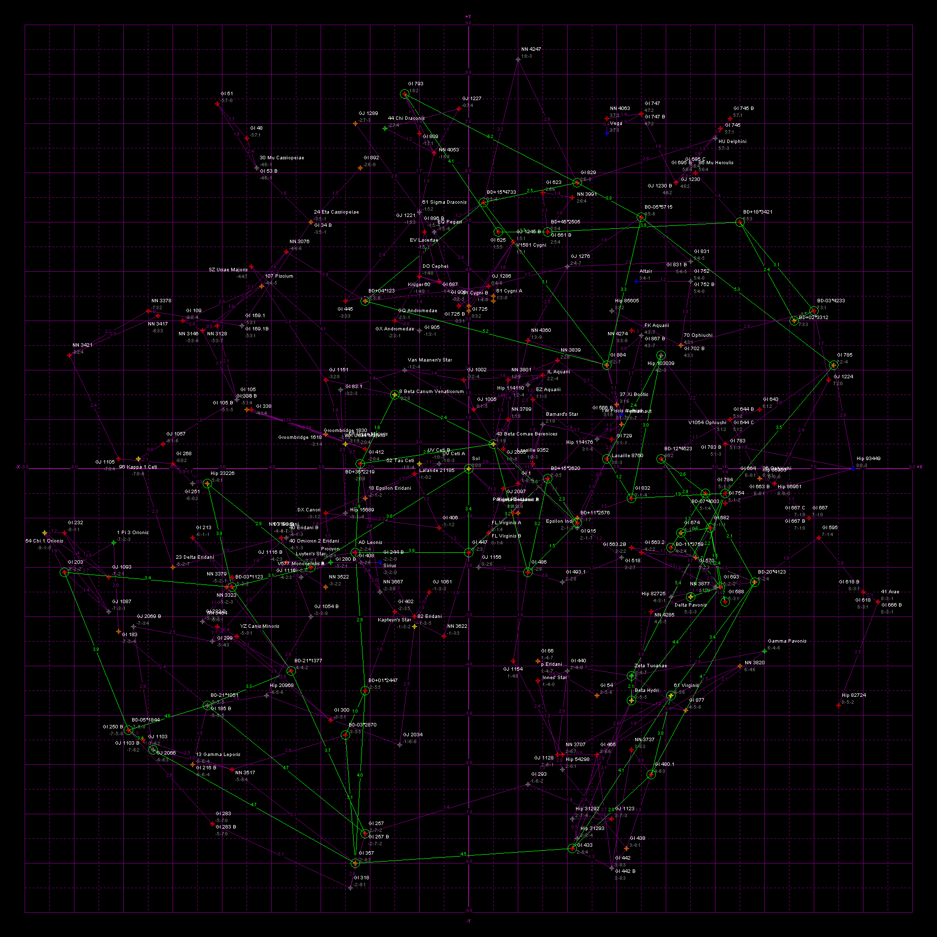
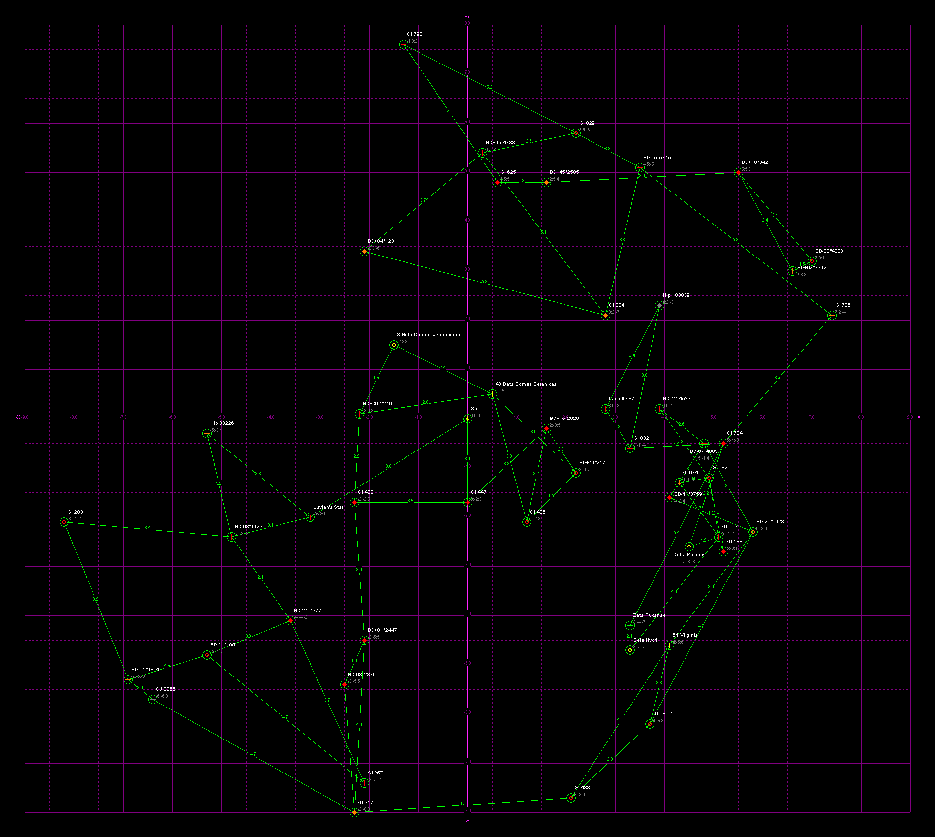
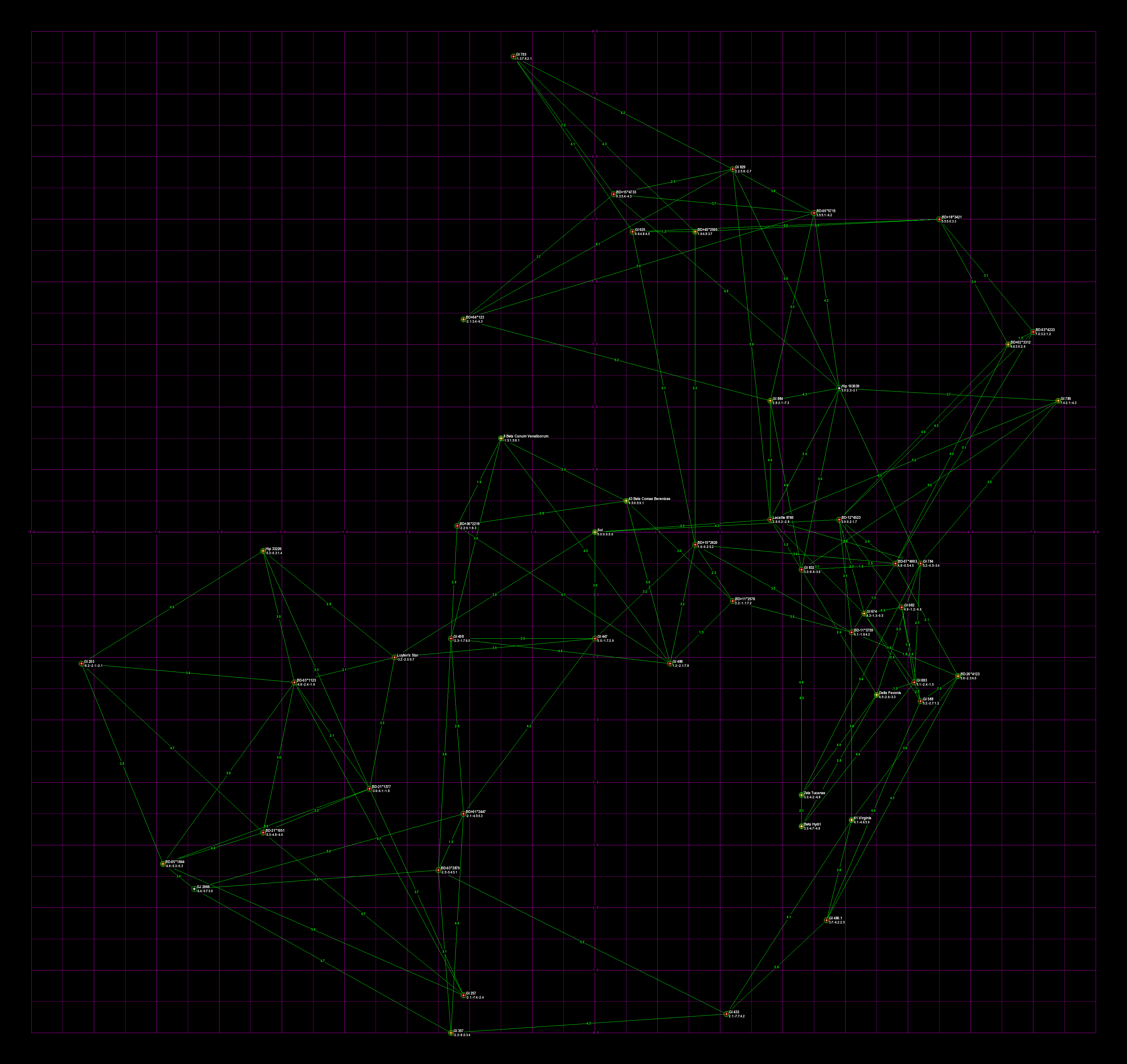
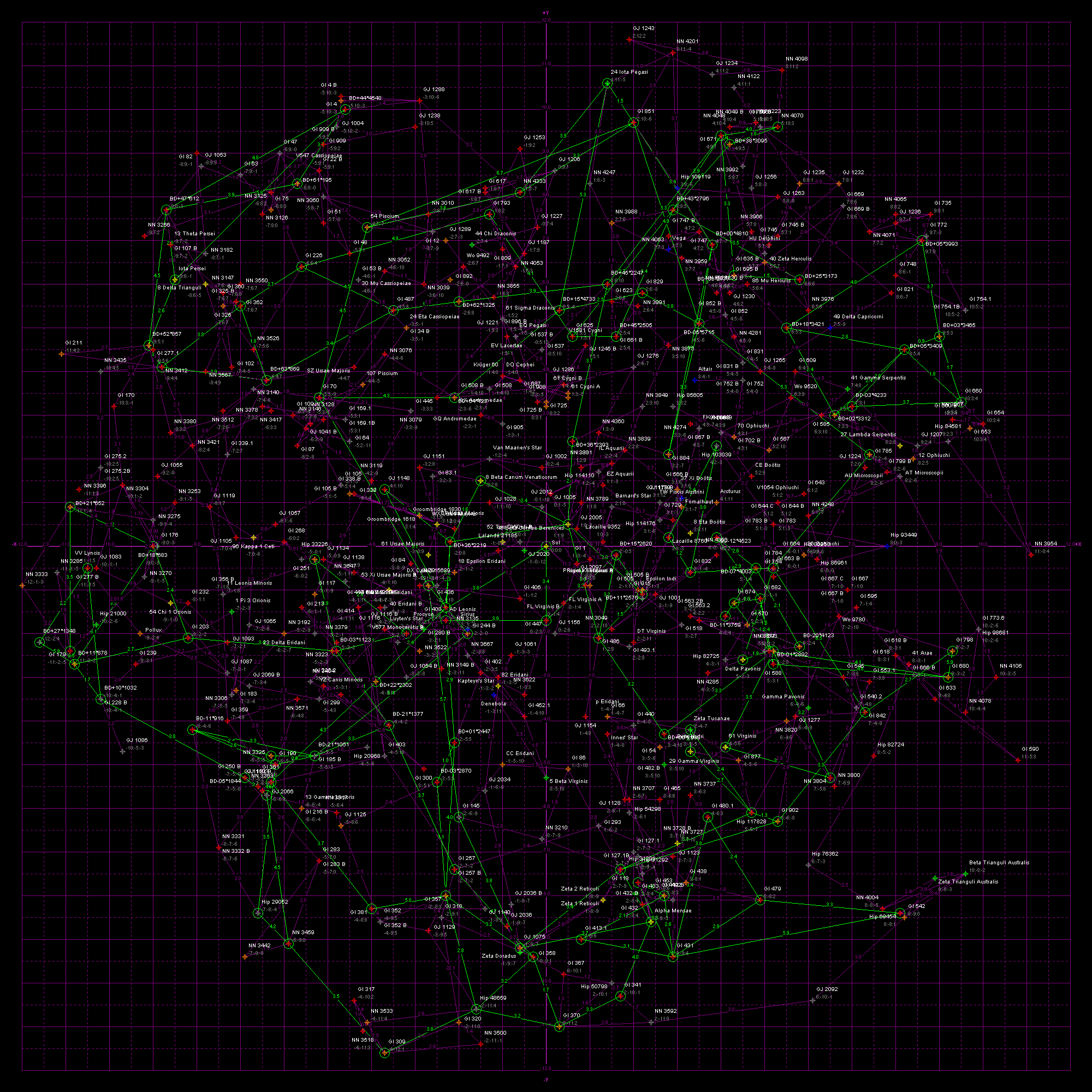
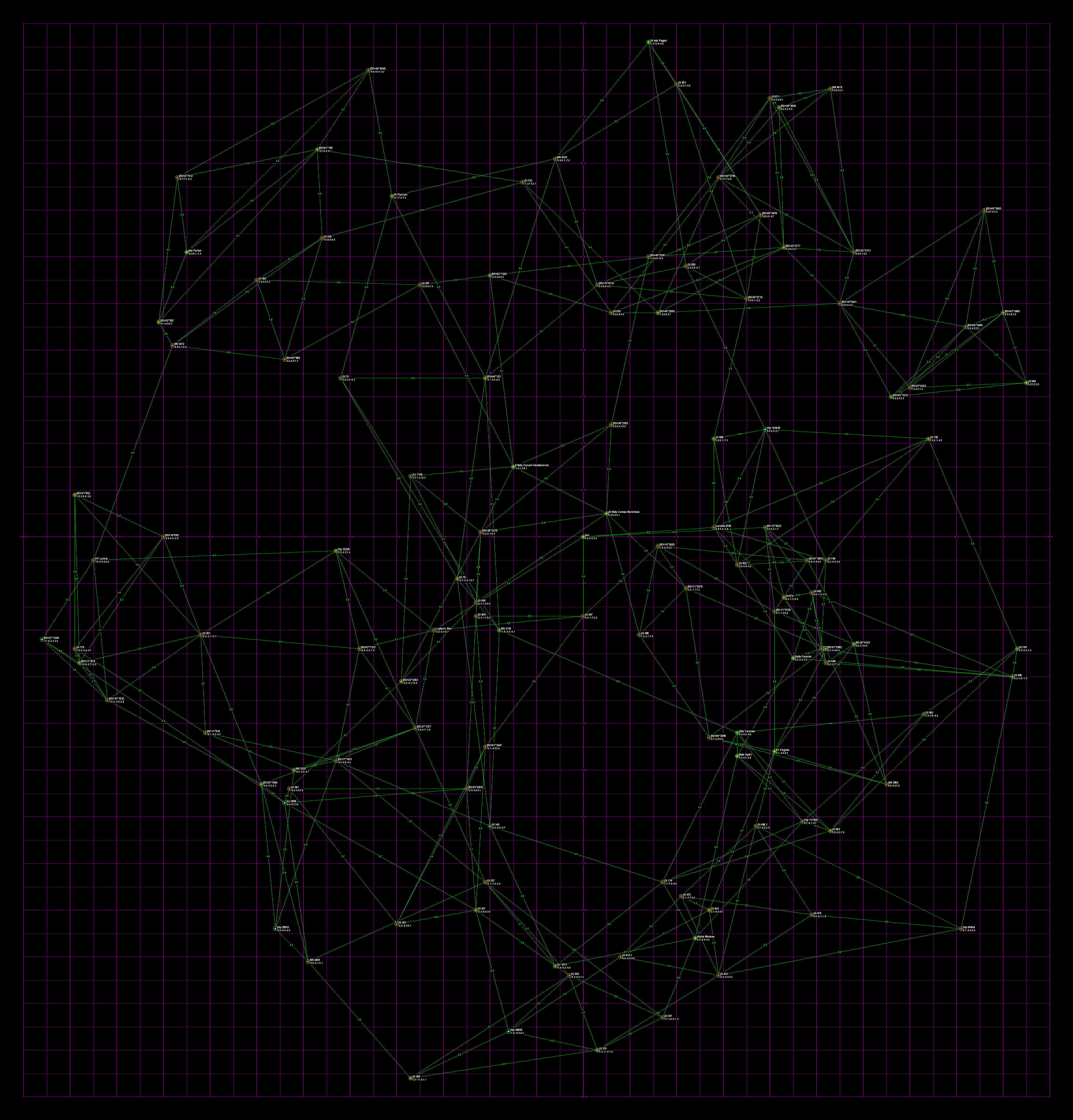
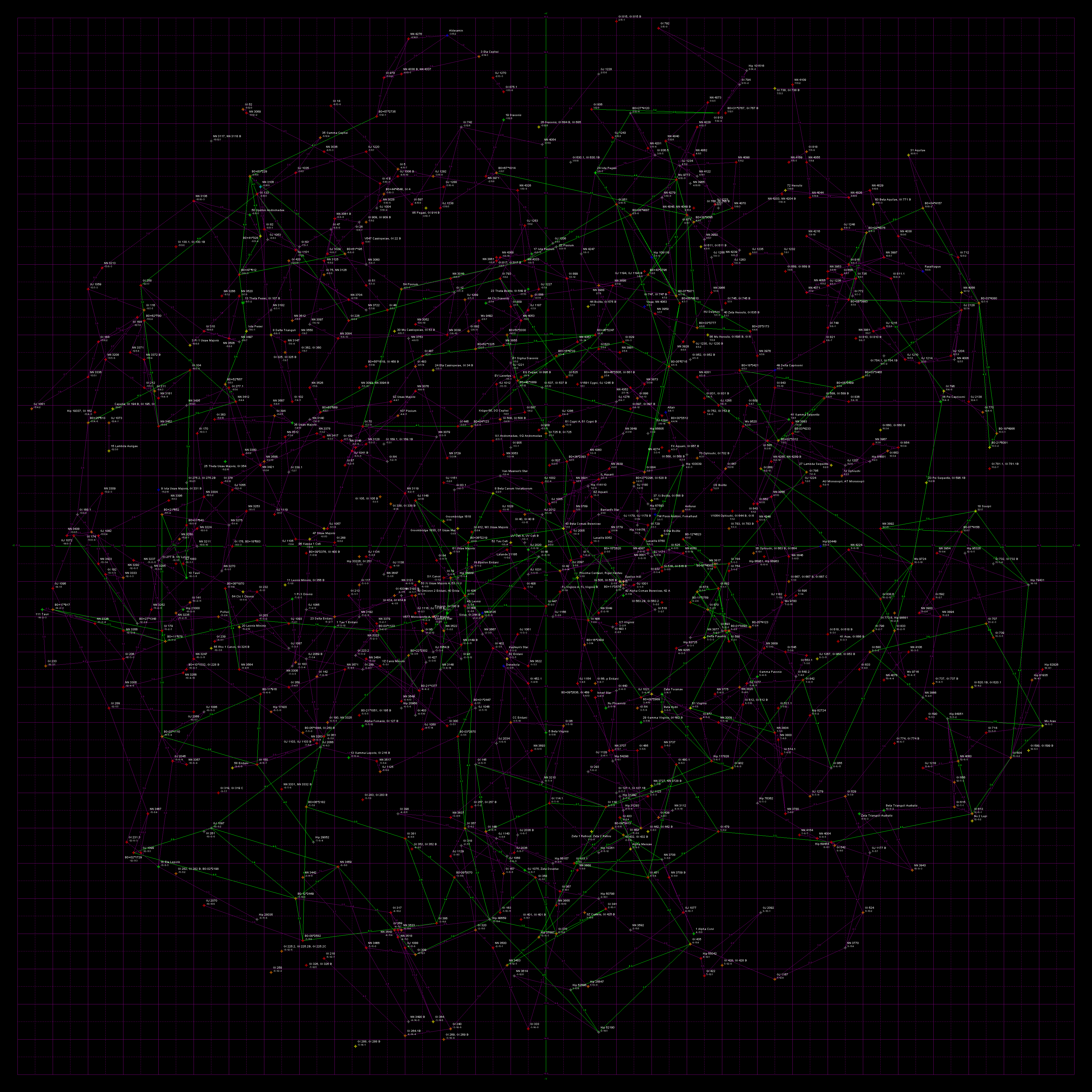
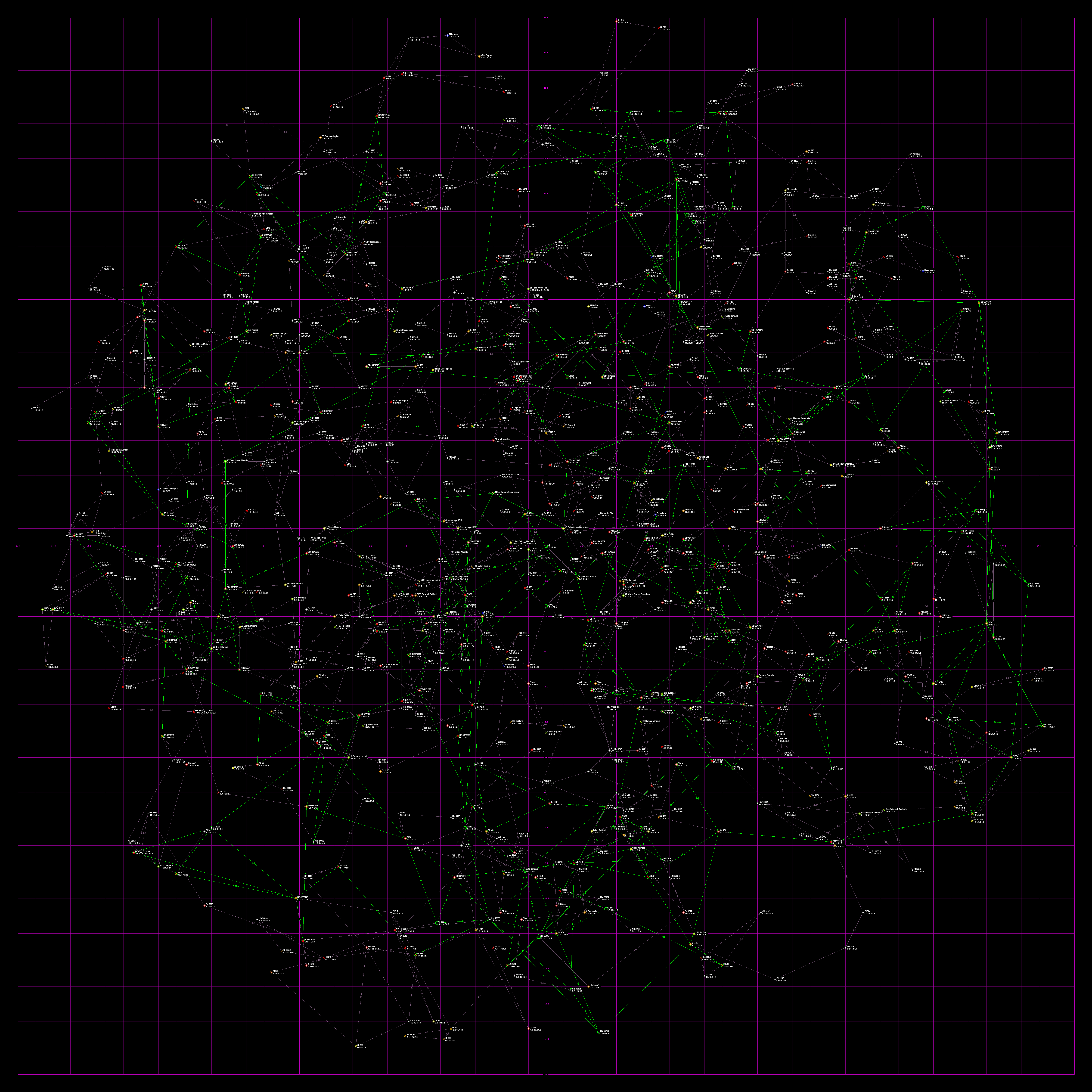
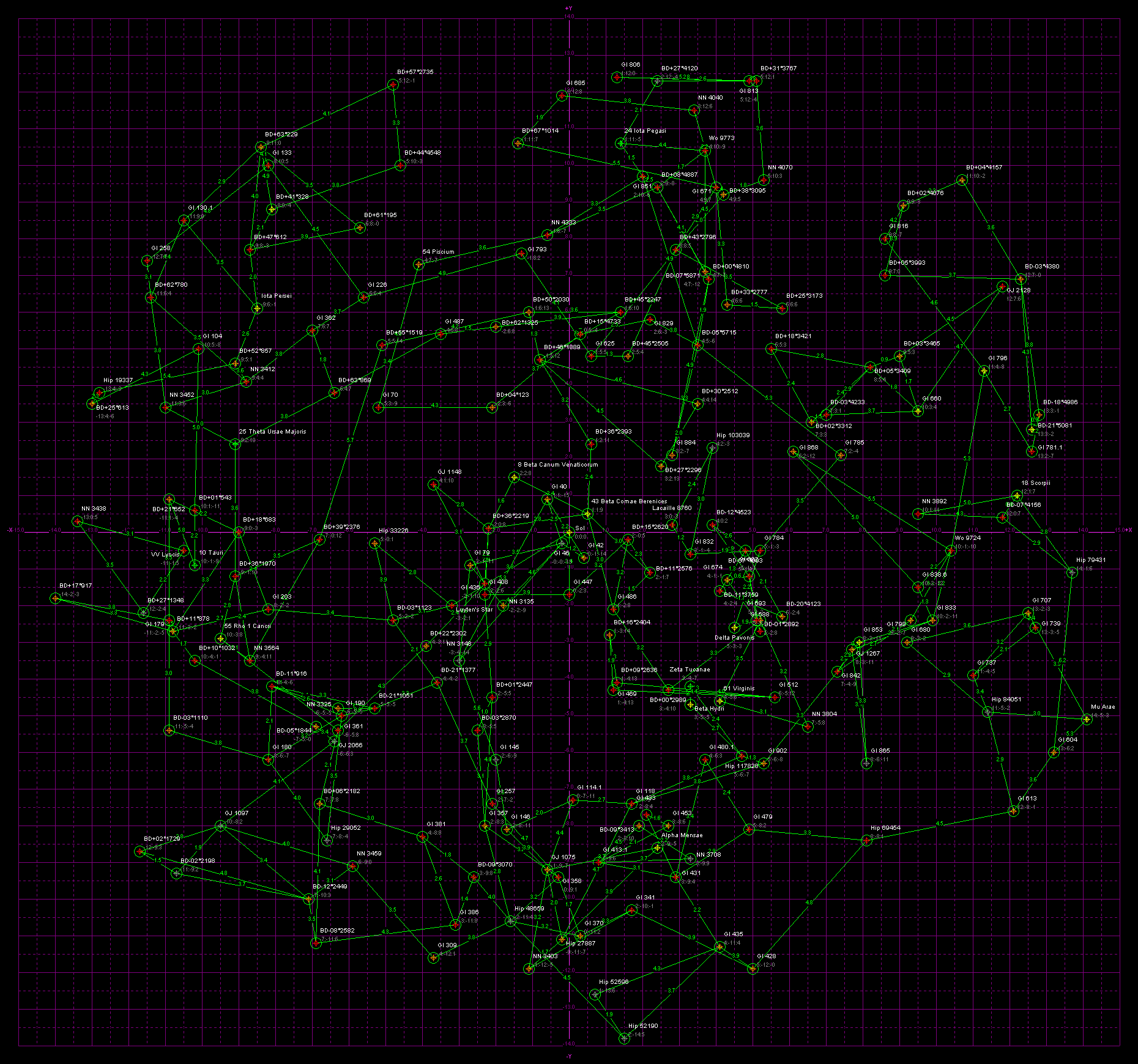
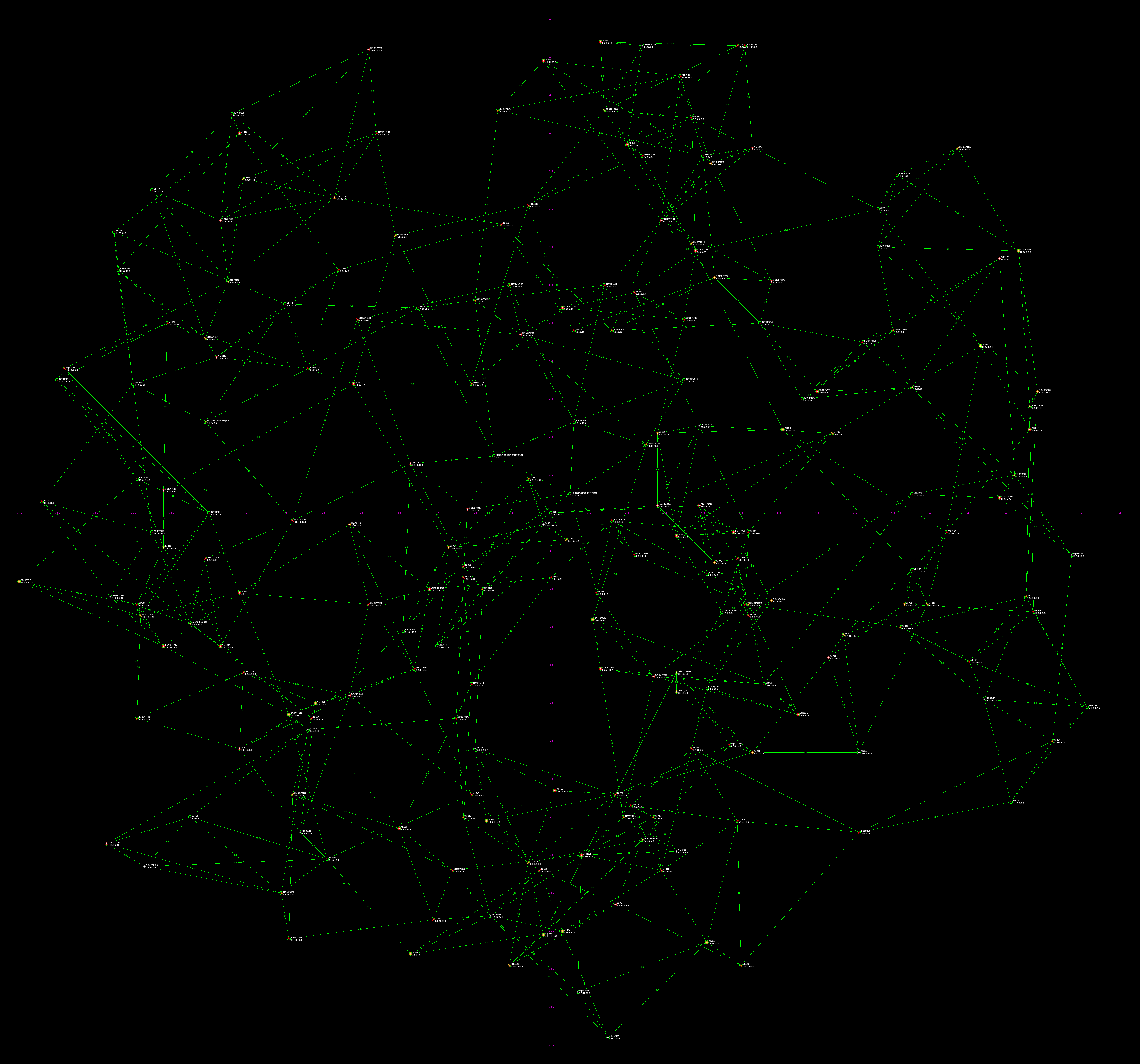
The following are based on the HabHYG dataset (i.e., they are as up to date as I can make them). I hereby grant permission for anybody to freely use these maps or lists in their novels, games, or projects. Acknowledging this website as the source would be nice but I do not insist upon it. The main thing is to get accurate 3-d starmaps in wider circulation. Note that the maps are automatically generated by software, not by hand, so sections of the maps are a tangled mess.
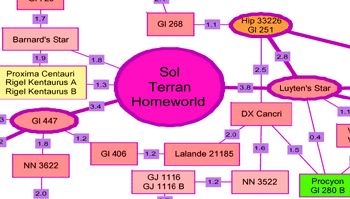
Galactic co-ords, galactic core is in the direction of the +X axis, -X is rimward, +Y is spinward, and -Y is trailing. All units are in parsecs (again: multiply parsecs by 3.26 to get light-years). Stars likely to possess habitable planets are circled in green. Each habitable star has green lines linking them with the closest two habitable stars. Line are labeled with the distance in parsecs. On the maps with non-habitable stars, in addition each non-habitable star has purple lines linking them with the closest two stars. These lines are just to give one a feel for a star's neighbors. If all the lines were drawn the map would resemble a cobweb made by a spider on LSD.
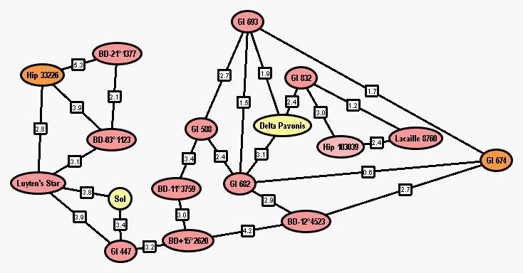
Also included are versions of the map in node or 2-1/2 D format. Remember, lines are only included for a star's two closest neighbors. Different maps would result with different line rules (e.g., a neighbor stars within distance X, single closest neighbor, stars with similar masses, lines joining all stars except where intervening stars too close to the line choke it off, etc.). The *.gml files have also been included in case you wish to move the nodes around yourself. These files can be used with the yEd software discussed in the 2-1/2 D section.
The gif maps were drawn with my crude program StereoStar. I included the *.str files used by StereoStar. Warning, the program is crude and very buggy. Use at your own risk.
The line lists are simple text files with the start and end points of each line.
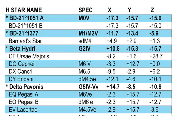
The star spreadsheets are in comma separated format. Column one is the HabHYG index number. Column two is the Hipparcos catalog number. Column three is the habitability flag, 1 = star has a high probability of hosting a human habitable planet (i.e., it is listed in the HabCat database). Column four is the name displayed on the map (i.e., the most colorful name out of all the possibilities, in my opinion). Column five is the HYG catalog number. Column six is the Bayer-Flamsteed name. Numbers and greek letters are alternate prefixes (e.g., "18 Epsilon Eridani" can be called either "18 Eridani" or "Epsilon Eridani"). Column seven is the Gliese catalog number. Column eight is Bonner Durchmunsterung catalog number (used by James Blish in his "Cities in Flight" novels). Column nine is the Henry Draper catalog number. Column ten is the Hoffleit Bright Star catalog number. Column eleven is the star's proper name, if any. Column twelve is the star's spectral class. Column thirteen is the star's distance from Sol in parsecs. Column fourteen through sixteen is the star's xyz galactic cartesian co-ordinates in parsecs (used to draw the maps). And column seventeen is the star's absolute magnitude.
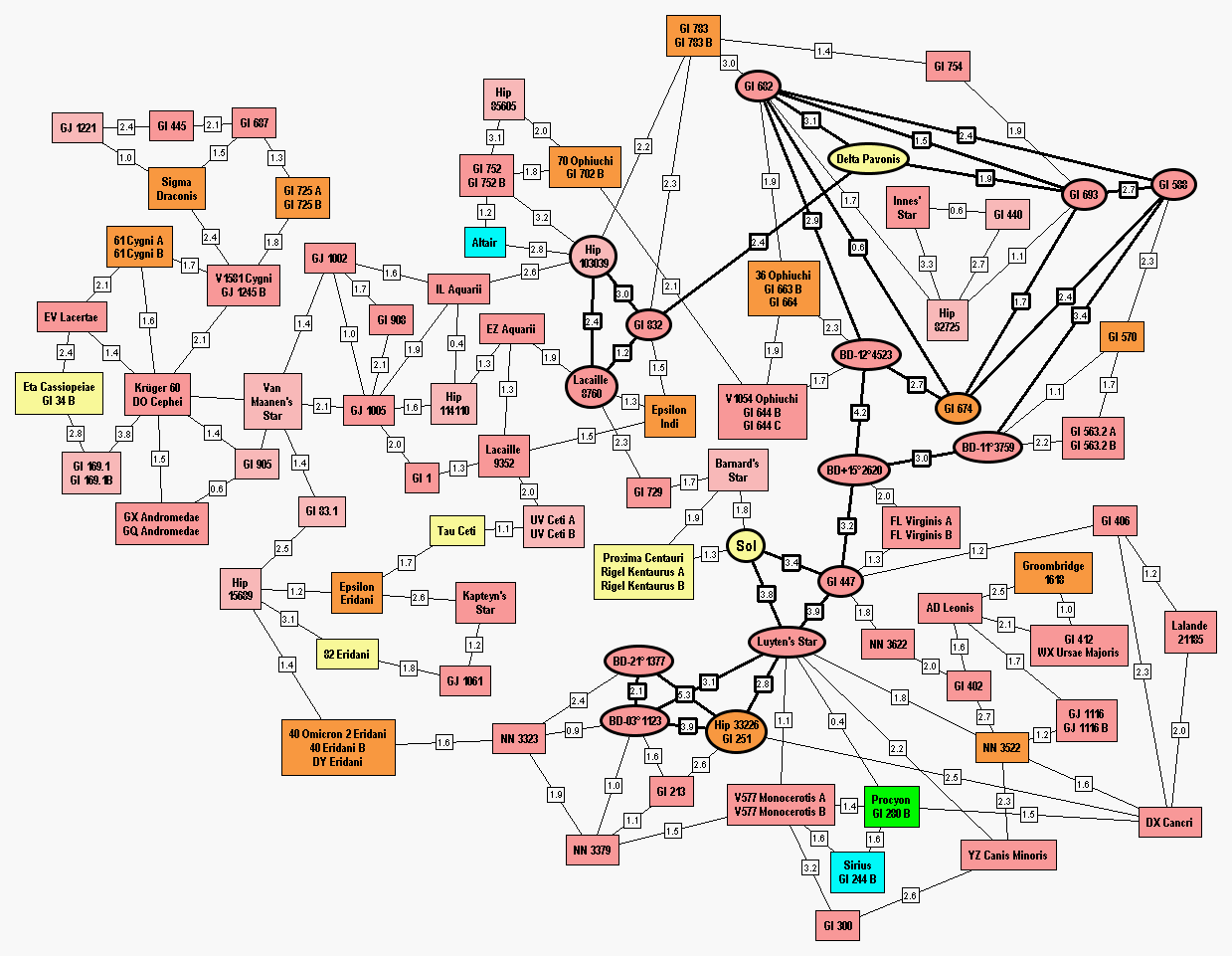
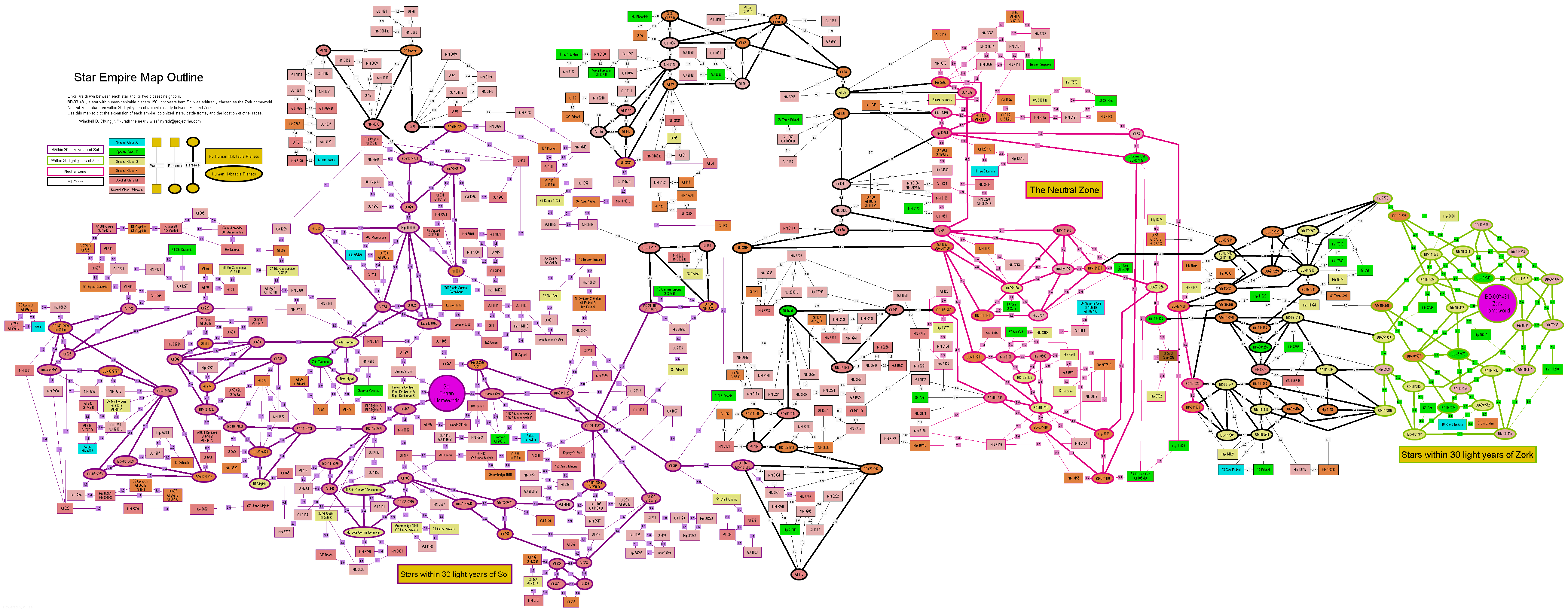
Here's the result of my experimental Interstellar Empire Framework project.
I started with one empire centered on Sol. For the dreaded center of the evil Zork Empire, I looked at the HabCat database and arbitrarily picked a star that was 150 light-years away from Sol: BD-09°431. The locations of the two empire centers was averaged to locate the point exactly midway between.
The map is going to encompass a capsule shaped volume, that is, a cylinder with both ends capped by hemispheres. This will represent two 60 light-year diameter spheres (30 light-year radius), one centered on Sol, the other on Zork Prime. The rest will be in a cylinder 30 light-years in radius connecting the two spheres.
The 60 light-year diameter spheres will be the "spheres of influence" of Sol and Zork. Another 60 ly diameter sphere centered on the midpoint will be the Neutral Zone. The idea is that the intrepid empire builder will decide which stars have been explored, which have mining colonies, which are colonized, and which are officially part of the empire. Once the enemy has been discovered, the neutral zone will alternate between being a demilitarized zone and the main battle line. As previously mentioned, this will be populated by spies, smugglers, covert battlefleets intent on causing boarder incidents, and planets named "Casablanca".
So I wrote a quick Python program and fed it a subset of the HabHYG database. It filtered out all the stars outside of the capsule volume and generated lines between each star and its closest two neighbors. Stars inside the two spheres of influence and the neutral zone were color coded. The program outputted this data as a GML format node map.
I then opened the file in yEd, autoformatted it, then laboriously tweeked it until it was compact. I saved it as a GIF file, and as a WMF file. I then used Adobe Illustrator to tranform the WMF file into a PDF file.
Here is the GML file (453k). Here is the GIF file (455k). Here is the Acrobat PDF file. Here is the StereoStar file. Here is the List of lines.
Have fun with it.
+=======================(:)=== ^ ===(:)======================================+
|   WINCHELL CHUNG      |=|   /_\   |=| I'm nobody. Nobody at all. But the   |
|Nyrath the nearly wise |\|  <(*)>  |\| secrets of the universe don't mind.  |
| nyrath@projectrho.com |=| /_/|\_\ |=| They reveal themselves to nobodies   |
|                       |\|  //|\\  |\| that care. OUTER LIMITS: Galaxy Being|
+=======================(:)=///|\\\=(:)======================================+